Drones Used in Dune Vegetation Monitoring
This year’s Quinovic Study Award recipient Michael Fake has also been busy analysing his drone generated pictures.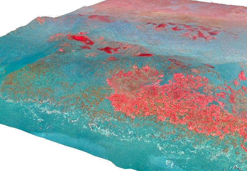 The work forms part of a wider project led by the Department of Conservation (DOC), who are interested in the potential application of aerial drones for the continued monitoring and management of important conservation areas around New Zealand. Dune systems have been highlighted as being of good potential for the testing of this technology as dune systems are typically smaller than other conservation areas, have a simple topography and exhibit clear zonation in vegetation.
In particular, DOC are interested in the potential for aerial drone survey data to provide such information as: up-to-date vegetation classifications for the identification and monitoring of important species, the detection of non-target species impacts from spraying operation, and the characterisation of species’ habitats within the dune system. This work focuses solely on two important coastal dune systems; Kaitorete Spit, a large barrier beach system which lies south of Banks Peninsula in Canterbury, South Island, and Ocean Beach, an important dune system within the protective boundaries of the Cape Sanctuary near Cape Kidnappers in the Hawke’s Bay of the North Island. Both areas are important both ecologically and culturally, yet both are also at risk from anthropogenic activity, namely on-going agricultural and recreational activities in the area.
Read more about this here (PDF, 1.08 MB).
Photos shows a 3D model of a section of Kaitorete Spit, coloured for species identification.
Posted: 22 December 2014 in the News category